
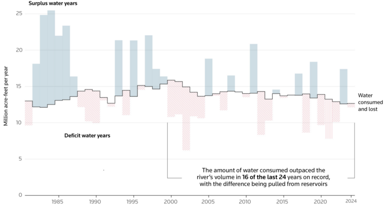
The Colorado River is at risk due to drought and states using more than the river provides. For Reuters, Travis Hartman and Andrew Hay mapped and charted how volumes have changed over time.
Water use peaked in the late 20th century. Consumption has eased since, but the U.S. still draws more from the Colorado than the river provides — a gap widened over the past two decades by a megadrought that has pulled reservoir levels sharply lower.
This is a very flow-centric piece. It starts with a moving water line, which ends up being the top of a Sankey diagram. The bar chart uses the same water pattern that moves a little bit at the top. Then there’s a map of the actual river.
Tags: Colorado River, consumption, drought, Reuters, water